Some Notes on the Route

July 24
Cape Flattery to Kauai
Day 2
Noon position: 44.43.84N by 127.11.35W (WSW of Portland, Oregon and 130 miles offshore)
Miles since last noon: 158
Total miles of passage: 274
Avg. Miles per Day: 137
Course: SSW
Speed: 6 and 7 knots
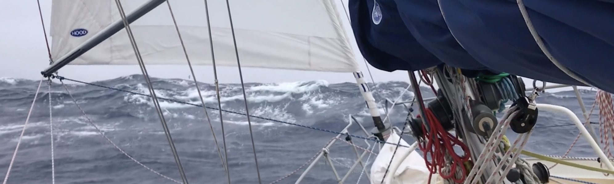
Wind: NW 10 – 20
Sky: Clear in the afternoon and until 4am; now solid gray
Waves: NW to 4 feet
Air Temperature: 65 degrees
Sea Temperature: 60 degrees
Wind came up suddenly from the NW around noon yesterday and has continued light to moderate. I’ve been running a heading of about 210T under a full main and working jib with wind on the beam or just aft, and the miles are clicking by … 158 of them in 24 hours to be precise. It all seems so effortless. The boat makes 7 knots like it’s slicing warm butter, this while I do nothing but watch and marvel.
Midway through the afternoon we sailed into a vast circle of open sky; cloud pushed inexplicably to the horizon as if on purpose and by someone who knows his geometry. The water turned cobalt blue and the sea foam cast by the bow frothed like fresh cream.
All of which helped to clear my departure-addled brain.
Sleep has helped too. I took two 1-hour naps yesterday afternoon and slept in easy 1-hour shifts last night from 10pm to 6am. Feeling more myself now…or at least less that other self. Not sure which “self” is “myself.” But I know which self I prefer.
Sun didn’t last. Buy rights we’re too far north for sun anyway. Today the cloud deck is down to the horizon in all directions. But wind is up. Nearing 20 knots NW. Still under full main and working jib, but have spent the morning trying to balance perfectly what is just a touch too much sail. I’m greedy. I like to see 7.5 knots. Finally took one tuck in the jib, which has settled much of our yawing if it has also taken the edge off our speed.
—
Notes on the Hawaii route:
-Distance as I’ve laid it out: 2700 miles.
-Expected duration: 20 – 25 days.
-A direct route from Cape Flattery to Hawaii, only 2200 miles as compared to the above, is typically not possible for sailing vessels, this due to a weather feature known as the North Pacific High that, in summer, is parked in one’s path. I’ve spent hours trying to understand what a high pressure system is, in fact, but am always forced back to analogy: think of it as a mountain of air nearly as wide as the US. Wind falls off its sides in a clockwise direction, but the center is calm. Point of the story: sailboats go around rather than through.
-For vessels departing from the Pacific Northwest for Hawaii, this “going around” usually means shaping an initial course that trends south along the coast. Jimmy Cornell, for example, recommends maintaining this southerly course until the latitude of San Francisco before trending west and then into the NE trades.
-My course thus far has more west in it than might typically be advised. This is partly because the current wind angle makes this a speedier (more fun) sailing direction, partly because I crave sea room, and partly because the GRIB files show the High elongating like an egg from NE to SW over the next week. If this holds, I may not have to sail so far south before beginning the turn west.
This will be especially good from the standpoint of hurricanes and tropical storms. So far, the monsters have been growling around in an area S of 25N. They haven’t “jumped the fence,” as it were, but that is unlikely to last the season. Thus, the course I’ve plotted (see attachment) takes me west along a line at 30N until I’m directly above the island of Kauai, at which point I can dive directly south.
Admittedly, the line at 30N is at the upper limit of the trades, and I may risk lighter winds near the end. This dog-leg also adds about 300 miles to the course, but this boat can knock that out in two days in good wind, and adding two days to a passage of 20 is cheap insurance indeed.

Provisional route to Hawaii based on time of year.

GRIB file showing shape of high by next Wednesday.