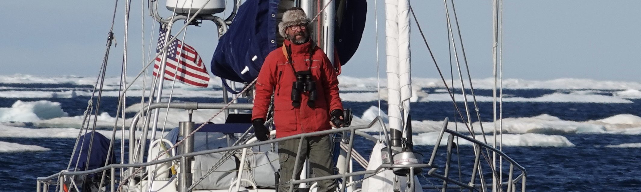
Astronav Update: Mistakes were Made
May 10, 2019
Day 217
Noon Position: 19 28N 54 27w
Course(t)/Speed(kts): NxW 3.8
Wind(t/tws): WNW 4
Sea(t/ft): —
Sky: Squalls on al sides
10ths Cloud Cover: 5
Bar(mb): 1017
Cabin Temp(f): 86
Water Temp(f): 90
Relative Humidity(%): 64
Sail: Big genoa and main, reaching on port
Noon-to-Noon Miles Made Good (nm): 69
Miles since departure: 29,277
Avg. Miles/Day: 135
Leg North Miles: 6,349
Leg North Days: 51
Avg. Miles/Day: 124

Most of the night we made between two and three knots. The sky started clear, but by morning, Mo was walled-in by heavy, black squalls. Nothing moved for several hours. Only when windlessness holds one prisoner in this way does such an intensity of quiet feel oppressive.
Then, just after noon, the squalls melted away and a cool, north wind filled in. On that we now make six knots on an empty sea under an empty sky.
—

I chose a challenging week on which to darken the chart plotter, and then I committed several bone-head blunders.
Firstly, we were passing under the sun on the first couple of days of this exercise. This phrase, “passing under the sun,” indicates that ship latitude and the sun’s declination (the celestial word for latitude) are converging. Ship and sun are nearly on the same plane.
In this case, when I switched off the plotter display, our latitude was just over 17N and the sun’s declination was approaching 17N.
The effect is that the day’s sun shots, which are attempts to triangulate your position from the sun’s different positions throughout the day, don’t produce a nice triangle of intersecting, you-are-here lines, what sailors call a cocked hat. Rather, the lines run nearly parallel to each other.
This does’t mean one’s results are wrong, they just appear less precise, and as such, they do not add to one’s confidence in his work.
Then I moved my watch up to GMT+4 and set the minute hand just slightly askew of its mark. That night’s star shots were a mess. A four second error in time keeping causes error of a mile in the results; so, you can imagine what being off sixty seconds will do.
Then I bonked the horizon mirror coming on deck and didn’t catch that I’d caused a two minute index error until the next day.
But we’ve worked through the bugs and have remained relatively sure of our position.

The most difficult day so far was yesterday. Recall that this is largely an exercise in dead reckoning (staying aware of ship position between fixes via compass and log), and you can imagine what light, fluky, ever changing wind will do. Now our course is northwest; now north; now west; now becalmed but moving with current. After a few hours of this, I’m lost. So it was gratifying to find that today’s dead reckoning was not too badly adrift from the noon fix.
—
Much of learning astronav is learning how to deal with error, because there is so much opportunity for it in the many steps from sight to fix. A three-shot sun fix (morning, noon, afternoon) requires roughly 60 separate actions; not one is the least bit difficult, but they are legion.

At first, you hedge your bets by taking multiple shots; if one doesn’t seem to be working out, move on to the next. But after a time you become confident in your ability to shoot a heavenly body (especially in middle latitude conditions), and so you take but one. If that shot fails, you backtrack into your calculations for the mistake.
Most errors are simple. Did you carry the one? Did you add rather than subtract? Some errors in time keeping are easy to remedy. For example, a shot that is out by around 15 miles is likely due to grabbing the wrong minute of time from the watch. Often if my corrected altitude and computed altitude aren’t close, I’ll scan the Sight Reduction Tables page for a computed altitude that is close and take its corresponding Local Hour Angle back into my computation. This often shows I’ve picked up the wrong data from the Almanac.
You also become fiendishly focused on accuracy. When recording an altitude, I often talk to myself as I read the result off the vernier. “That’s 34 degrees, not 35; not 39; that’s 45 minutes, not 35; not 40,” etc.
—
When it all comes together, it’s easy to feel The Great Navigator.
Then one must recall that there are more than a few people reading these reports who had to learn celestial to go off shore … because when they went exploring, there was no other option. In one generation, proven methods of way finding in use for hundreds of years, have been largely forgotten.
I’m impressed enough with your celestial navigational abilities, but equally, I just realized it’s probably senior Mo doing the photography of you doing your thing(s),Please congratulate him. He’s doing a great job with your camera.
Thanks for another great navigation post! That’s a useful lesson learned. I’m preparing to navigate the Marion-Bermuda race and other crew members may also be using the sextant. I’ll ask that we make it standard operating procedure that if anyone “bonks” the mirror, to note it in the log.
That is a true revelation. For me, I chose to always be amazed at how electronic advancements have improved the world. None the less, I am inspired to pick up the sextant and keep practicing. Question what whisker pole do you use for the Genoa’s?
I started to look at this problem of celestial navigation and what I found was a beautiful mathematical construct of understanding this world.
I need o go back to it and one day use it at sea. Thanks Randell but where are the SE trade winds? Fair winds
Randal is using the”Line of Position” navigation method, first developed and published by Captain Sumner in 1837, and refined by Marcq St. Hilaire, actually less than 200 years ago. Before the development of Harrison’s Chronometer in the mid to late 1700s there was no reliable way to determine one’s longitude at sea. Once mariners and land explorers had chronometers, positions were determined by terribly complex solutions of spherical trigonometry. Captain Sumner’s discovery made the process much easier, but still a trial by numbers. Such a brief interval between the first chronometers and GPS satellites! Randal’s sharing of errors and corrections is great stuff if you’ve ever tried to do this.
Randall, your story of the sun directly overhead immediately brought back 1986 sailing from Vanuatu to the Solomon Islands & finding ourselves not finding land. We were shocked! Tony went back to the noon sites & discovered the sun right over top. Then he went to Eric Hiscock’s book, our bible, found the appropriate chapter & how to work the sight. We found ourselves on the south side of the island not the north side where we were headed. But also anchored in a delightful bay where locals paddled out in canoes asking for calico, dictionaries & pencils. It was a celestial navigation mistake that turned out for the best.
We will be “near” each other soon. We are at 38 degrees north, anchored off Cape May, NJ. Disgusting cold fronts roaring through. Hope they are gone when you get this far north.
Hugs, Coonie
S/y Sage
This wouldn’t be Herb Payson’s daughter, Connie would it? If so, we knew one another in the Pacific and Hawaii. Is it you???
Geez.Randall, when sextant was all we had, we were quite happy to be within 20 miles of accuracy. We did the rest by one of sight!
Randall, you really must see the show at our planetarium in Honolulu of Hawaiian navigation methods – no sextant, no GPS. It’s quite fascinating. Not difficult but requires lots of memorization of the sky.
I’m just starting to catch up on your posts – lost my mom recently.
Be encouraged, Randall! There is whole new generation of Navigators. The Polynesian Voyaging Society is alive and well with Master Navigators teaching their voyaging by the stars, sea and wind. http://www.hokulea.com/
Pingback: Message in a Bottle–The Full Story – The Figure 8 Voyage