Gray
July 16, 2019
Day 244
Noon Position: 50 28N 52 06W
Course(t)/Speed(kts): NNE 5
Wind(t/tws): ExN 9
Sea(t/ft): NE 3
Sky/10ths Cover: High fog, low fog, drizzle, rain/10
Bar(mb): 1011, steady
On-deck Temp(f): 54
Cabin Temp(f): 59
Water Temp(f): 45
Relative Humidity(%): 62
Magnetic Variation: -18.7
Sail: Working jib and main, full, close hauled
Noon-to-Noon Miles Made Good (nm): 157
Miles since departure: 32,000
Leg Newfoundland to Nuuk
Days: 2
Miles: 181
Average Miles per Day: 152

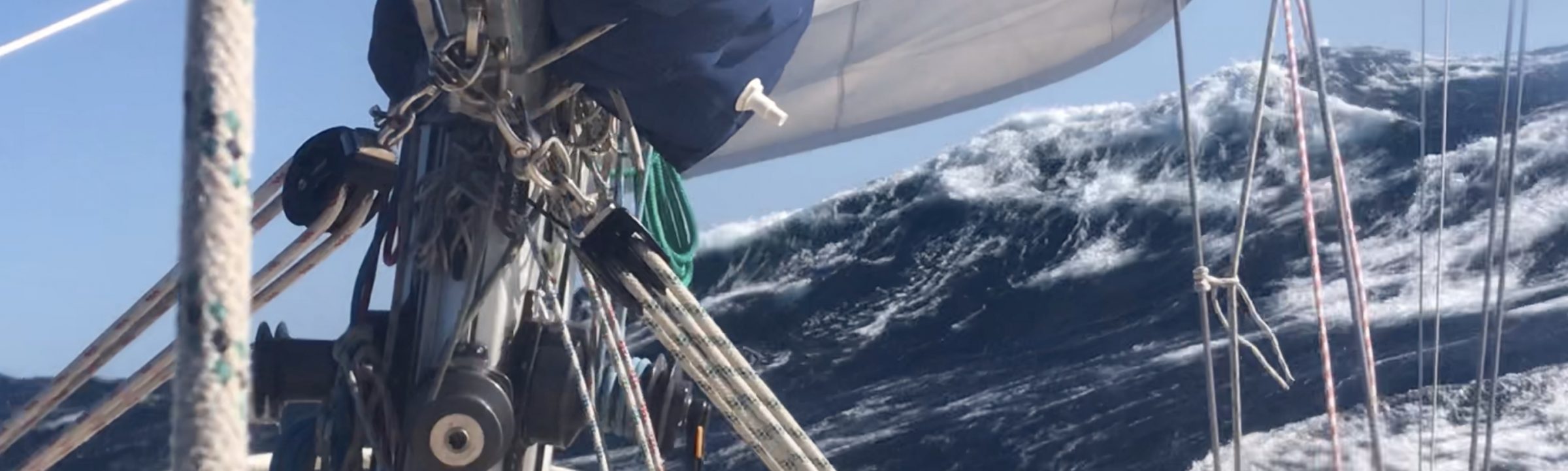
Gray on gray. The fog came in hard at the Baccalieu Tickle yesterday. Within the hour it was raining. Since then it’s been variations on same with a kind of wet chill that is reminiscent of the Southern Ocean.
When I woke, the on deck thermometer read 50 degrees; water temperature, 47. The first layer of thin thermals went on after coffee, the thin layer because, well, this is just the beginning.
We make good time on a wind that swings between SE and E. Most of the night the breeze was dead abeam at between 15 and 20 knots, and Mo frothed along in celebration of a clean bottom and achieving the freedom of the open ocean once again.
My strategy is to keep a bit of east in our northing so as to edge around the outside of the iceberg belt. This may be overdoing it, as the forecast calls for one to two bergs per square degree in areas I’m trying to avoid. Imagine driving upon an open plane and being worried about colliding with a house that is somewhere within 2,000 square miles of you.* Still, easting is easy, so we’ll do it.

I’m fretting about this leg and want to push through as quickly as we can. Weather between Newfoundland and Nuuk is dynamic, with lows continually spinning down off the east coast of Canada. Once at the latitude of Nuuk, we begin to ease into a vast polar high pressure system. Winds will likely drop right off. But the chances of getting whacked before we get there are good.
Note some changes to the statistics. I’ve added an on-deck thermometer, and I’m starting to track magnetic variation, which may give interesting readings as we approach the northern magnetic pole.
*60 degrees of latitude = 60 nautical miles; 60 degrees of longitude at 50N = 39 nautical miles. 60 x 39 = 2,340 square miles in a square degree at 50N. Lots of space for one berg, but I’ve heard they’re mean when injured and hard to outrun.
Correction, July 22: The above should have used “minutes” for “degrees,” but would have been more clearly stated as restated here:
“A degree of latitude = 60 nautical miles; a degree of longitude at 50N = 39 nautical miles.” The calculation still stands and is a staggering number of miles in a degree of lat/long.
A goof. Not trying to re-size the cosmos. Thanks for catching the mistake, Sid.
Randall,
Not to be too picky but, I think you are confusing minutes and degrees of arc when doing your area calculations.
It is the “unit of measurement” on USCG on the chart pasted here, and the source here: (maybe 100KM X 100KM? ) https://www.navcen.uscg.gov/?pageName=iipCharts
Sid, could you please show the calculation using degrees of arc?
A goof. Thanks for catching, Sid. Correction: The above should have used “minutes” for “degrees,” but would have been more clearly stated as restated here: “A degree of latitude = 60 nautical miles; a degree of longitude at 50N = 39 nautical miles.” The calculation still stands and is a staggering number of miles in a degree of lat/long. Made a mistake. Not trying to re-size the cosmos.
Bergs be like a turd in a swimming pool i suspect Randall. Stay safe,
Looks like you are passing IPA cooling capability and approaching pilsner, then pale lager, and finally PBR!
Sailing tonight you were a great point of conversation with the crew, you’re inspiring a lot of us. Keep on keeping on!
I hope you rethink your new math post “*60 degrees of latitude = 60 nautical miles” Bowditch, USCG et al licensed mariners continues to support the old navigation standard of 1 degree of latitude = 60 nautical miles. Check you nautical charts.
Never pick longitude for distance since its different at every latitude.
Be safe! .
Today Pt. Barrow in Elson Lagoon deciding the best time to depart East for Herschel Island going North offshore around shore-fast ice.
Smooth seas,
Voyage Advise
aka M/V ANDROS.
This is just great. Be safe. Keep the faith. And thanks for your inspiring dialogue.