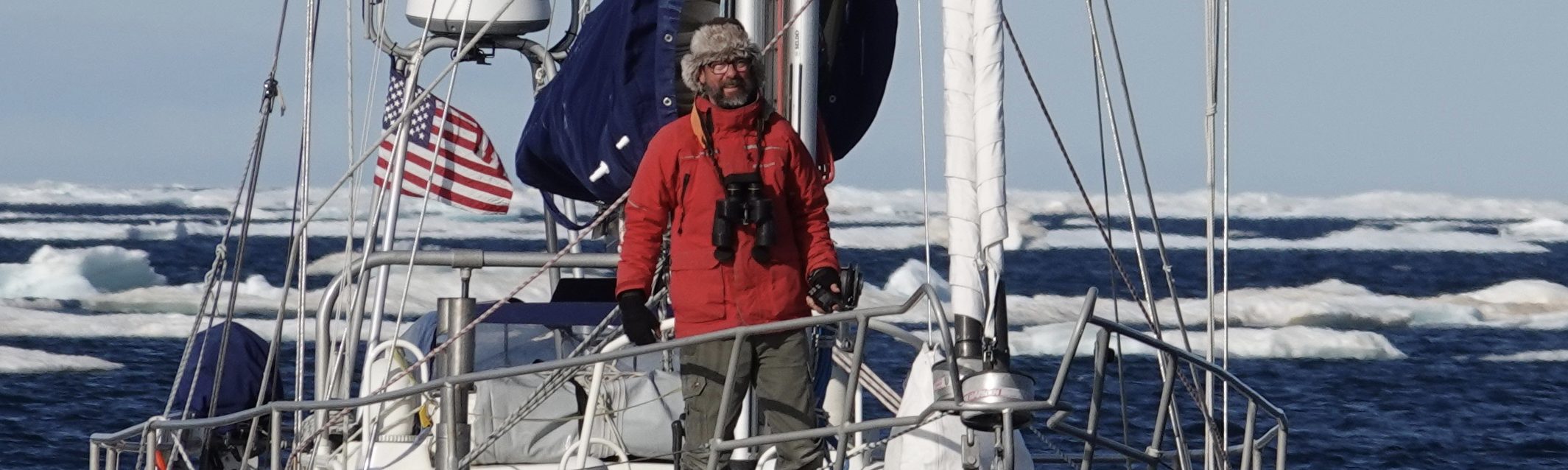
Running the Numbers
Day 71
Noon Position: 48 31S 32 31W
Course/Speed: E7
Wind: NW to 20
Sail: Big Genoa, out full, wind on port quarter
Bar: 1010
Sea: NW6
Sky: FOG!!! And drizzle, all day
Cabin Temp: 56
Water Temp: 45
Miles last 24-hours: 162
Miles since departure: 9241

How far is it back to Cape Horn? How long should the circuit take? What can I expect when I get there?
I do the distance math every day it seems, if not on paper, then in my head, each time hoping to find a carry-the-one error that will magically reduce the miles. It’s a long, remote, and exposed route under the best of conditions, and with the unexpected stop in Ushuaia, I’m behind my initial schedule, a schedule designed around approaching Cape Horn during the “least bad” times of year.
But what’s it mean to be behind schedule? What effect will it have?
First question: How far is it around?
My target latitude for the southern ocean circuit is 47S (subject to change without notice). The distance in nautical miles around that parallel is the circumference of the earth times the cosine of that latitude. So, 360 (number of degrees in the circle) times 60 (nautical miles in a degree of latitude) equals 21,600 (circumference of the earth in nautical miles) times the cosine of 47 equals 14,731 miles.*
I will need to drop back down to 56S in order to round Cape Horn again, but the further south I go the shorter the distance around the circle such that it’s nominally shorter to go from 47S around the Cape and back to 47S than it would be to sail a rhumb line between those two points, even if such were possible.
So, let’s stick with 14,731.
But that number assumes we maintain a perfect course due east for the entire circuit, which we won’t do. Sometimes I’ll want to head NE or SE to take the wind around the lows at a more beneficial angle. So how can I factor in this “inefficiency?” Not sure. I can say, by way of example, that over the last three days of easting, we have been 3.1%, 5.7%, and 5.0% inefficient respectively. Yesterday we sailed 162 miles from noon to noon based on our movement over the ground. However, the “miles made good,” the distance between where we were at noon yesterday and where we were at noon today was 157 miles. That’s a difference of only 5 miles or 3.1%.
Is that typical? Dunno. Unlike most other routes anywhere, my sail around the south will be almost entirely with the prevailing wind. So, let’s assume my miles made good each day will suffer from an inefficiency ratio of 8% (double the average of the last three days).
Total miles to sail, then, are 15,909.
Second question: How long should that take?
I’m budgeting 150 miles per day on average for the southern ocean loop (an average of 6.25 knots per hour). Mo’s hull speed is somewhere around 8.3 knots, so getting to 6.25 is no trouble if there’s wind. Our average for the first leg of this voyage (San Francisco to Cape Horn) was 136 miles per day just before steering failed; that included the doldrums and some painfully slow sailing on either side. Our average for the first eleven days of this loop is 144 miles per day, including three days of unusually calm weather just east of the Falklands. This is the windiest damned ocean on earth–I think 150 miles per day is achievable.
So, 15,909 miles of loop divided by 150 miles per day equals 106 days of sailing. I departed Ushuaia on January 12th, which puts us back at the Horn on (or around) April 28.
Third question: What can I expect?
A look at the Pilot Charts** suggests the “only difference” between a March, April, or May rounding of the Cape is an average increase in the number of gales per month from 2% to 3%, and not in every quadrant. In either case, that’s less than one per month. But we should note that the charts make no comment on changes in severity, just the percent of winds over Force 7 on the Beaufort Scale. Also note that Mo has already weathered two gales on the Pacific side and will encounter another by Friday. So, there’s that.
On the plus side, Tony Gooch notes that though the chartering sailboats that make the summer hop across the Drake Passage between Ushauai and the Antarctic end their gigs in March, they do so because they are making the passage with wind abeam and they are on a schedule. We have no schedule but to make it there and back, and we’ll be running with the wind.
Also, an interesting comment regarding late roundings comes from Moitessier’s THE LONG WAY, “Vito Dumas picked the end of May or early June to round the Horn from west to east. In his book, he considers that that was the best period. Being Argentinian, he was well informed.”
So, where does that leave us? Heading east with alacrity and being thankful for a well found boat with lots of food and water aboard.
*Many thanks to Matt, currently cruising on DRINA in South Georgia for the cosine formula. I hope to repay the favor someday by teaching him how to diagram sentences.
**Cornell’s Ocean Atlas, Jimmy and Ivan Cornell, South Pacific Ocean.
—
On a lighter note, I opened Kelton’s jar of Apricot jam today. That on my home-made bread, toasted, was a delicious way to start the day.

You need a good book to read!
Very much enjoy following along with you Randall! Thank you for taking all us armchair crew along for the ride!
Ditto!
Time at sea assumes a very different quality from time ashore. Perhaps it is the departure from man’s constricts of time ashore and the embrace of timeless time, nature’s time….the timeless time that began when life first dawned on this planet. It’s inevitable that you should do these calculations, as a prudent mariner, you must. And yet you will make it in whatever time it takes…..and by then, it will seem to have just been ‘a short time’
HaHa ! Did you ever here the one about the best economists in the world making millions of predictions on just about everything…and not one ever got it right. I hope you just enjoy every day of sailing and just deal with whatever comes your way…in a nice quiet way like your person seems to be able to deal with things.