
Sept 12
Hanalei Bay to San Francisco
Day 2
Noon PST position: 27.05.77N by 159.30.04W
Miles since last noon: 133
Total miles of passage: 302
Avg. Miles per Day: 151
Course: NNE to NW
Sail: Close hauled on starboard; all working sail; then added large genoa just before noon.
Speed: 5 – 7
Wind: ENE to 20; then NE10+
Sky: Mostly clear; rare, small cumulus
Waves: E1, NE4, then long slow NW6
Bar: 1014
Air Temperature: 85 degrees
Sea Temperature: 78 degrees
If it weren’t for the writing of this log, I’d still be sitting on the weather rail behind the main sheet winch admiring the day.
Soft, warm wind at my back, Mo’s gentle gallop over waves like low hills rolling down from the northwest; the sound from the bow much like that of a pulsing waterfall. And then, the view. Mo and her bright yellow decks gliding effortlessly over a big blue marble, undulating glass under a pale blue sky.
Maybe Talavera is right; maybe “the Western Ocean is infinite and unnavigable.” But if infinity is made up of days like this, it is almost a thing to be wished for.
I say effortlessly where Mo is concerned, but not her crew. For me it’s been a day of sail changes and sail tweaks and trying to claw as much northing as possible into our increasingly north wind. That there is barely any sea running helps.
For two days I’ve been working slowly east in hopes of catching up to the tale end of a low that may just be grazing 35N by 155W later in the week. But I’ve been lazy at night. As winds have eased and shifted in the wee hours, I’ve chosen to sleep rather than tune the violin, which is what orchestrating sail, rudder and wind vane on even the smallest upwind coarse changes can feel like. Let groggy head sleep; who gives a fig about five miles of westing?
But I give a fig, once awake. Two nights of laziness and one day of a northing wind means Mo and I are now west of Hanalei. I’d not usually care except that as far out as the GRIBS can see, between 30 and 35N and west of 160W is a glob of still air which I suspect will be the end of our joy and the beginning of trouble. If the passage to Hawaii is a sleigh ride, this trip home is an uphill slog. If I could just catch up to that low.
—
I’m not eating much yet and am certainly not cooking. Too hot. Yesterday’s intake included a carrot and a banana and a nutrition shake for breakfast. Lunch was an avocado and bread with peanut butter and jam; dinner, a can of lentils, eaten from the can, and two beers for desert. Much the same so far today.
This will change soon, however. The bread has betrayed me by going moldy with surprising quickness, even when kept in absolute dark. I bought two loaves less than 10 days ago and am already tossing half of each slice overboard. Avocados and bananas are all going ripe at once, which is their want. They’ll be gone within two days. Then it’s on to the more hardy bell peppers and zucchini, the apples and oranges, and then the hardier still canned and dry foods.
—
We’ve left the boobies behind and are back to the zone of tropic birds and arctic terns, of which two pair each today. The younger, drab colored tern dove (unsuccessfully) on the lure I’ve been trailing astern since departure. Adult birds always give the lure a look, but only the juveniles are fooled enough to go in. So far the hook has caught no flyers (ever may it be so); sadly, it’s also caught no swimmers since the scrawny, no-eyed Wahoo. I suspect that it’s not fooling anyone; refusing to drag any way but upside down, it looks like a super-speedy flying fish, long dead.


Sept 11
Hanalei Bay to San Francisco
Day 1
Noon PST position: 24.49.78N by 159.24.41W
Miles since last noon: 168
Total miles of passage: 169
Avg. Miles per Day: 169
Course: N
Speed: 6 and 7 knots
Wind: E20 then ENE15-20
Sky: Tropical cumulus then high cirrus and low cumulus
Waves: E3, NE6
Bar: 1012
Air Temperature: 85 degrees
Sea Temperature: 79 degrees
It’s not sweet sorrow, departing, unless bad sleep and a knot in one’s gut are how such is defined. The excitement of being in the ocean groove, of being, as Safina describes the albatross, “embedded in the wind,” must wait until the embedding occurs. The boat at anchor, or at least the captain at anchor, wishes for no such thing.
This slog over the high looks so long and contrary–all that northing, almost back to Alaska–before the turn east and south–that Talavera’s warnings against Columbus voyage ring in the ear. “The Western Ocean is infinite and perhaps unnavigable.” I’ve made this passage twice. It still feels that way.
But at least we chose the right day for our noon weighing. The strong trades were due east, a rarity, allowing an easy reach to the north, the sea under sun, an electric blue ball begging to be crossed. Spray everywhere, of course, as MOLI dove into a rolling northeast swell. But finally underway. The threshold had been crossed.
I say “we” because I am in company with another yacht, SOLACE, a 43 foot fiberglass sloop built in South Africa. She has three aboard; owner Steve Harris, daughter Kelsey and friend Kim Kirch. Kim, who took the excellent photos of MOLI as we exited Hanalei, has a business card that reads “boat captain, photographer, shredder.” Given my left coast orientation, I had thought that latter title a reference to the recycling trade and so had to withstand the shame of correction. Ah well, once a square, always a square.
I met SOLACE in Hanalei because of the twenty-five boats at anchor there, only we two were passing through, and because Steve offered cold beer and hamburgers one evening. Beer I have aplenty, an entire locker. But it’s not cold!
SOLACE started her summer jaunt in San Diego and arrived in Hilo via Ensenada. Now she’s headed home by way of Cape Flattery.
It is odd to be in company, interfering as it does with the “World of My Own/Knox-Johnson” stuff I am so taken with. But it’s fun to talk on the radio and to (unofficially) race.
All yesterday I had the weather gauge on SOLACE as we both reached north. By sundown I was three miles to windward and SOLACE hull down. But overnight and while I slept Steve snuck around my stern, and when I woke, he was six miles to windward, his mast the merest toothpick on the horizon. I’ve gained some of that back throughout the day, but who knows what he’ll pull tonight!


Caught my first fish. A Wahoo, I presume. Not much to him. Had been dragging so long his eyes had pulled out.

The Wahoo had the bad taste to be caught after dinner. So, instead of eaten on the spot, he’s being dried for later.
Renaming your boat is forbidden. The rule is unwritten, understood by all, universally ignored.
Thus it gives me pleasure to introduce the Figure 8 Voyage vessel, MOLI, nee ASMA, TAONUI, GJOA.
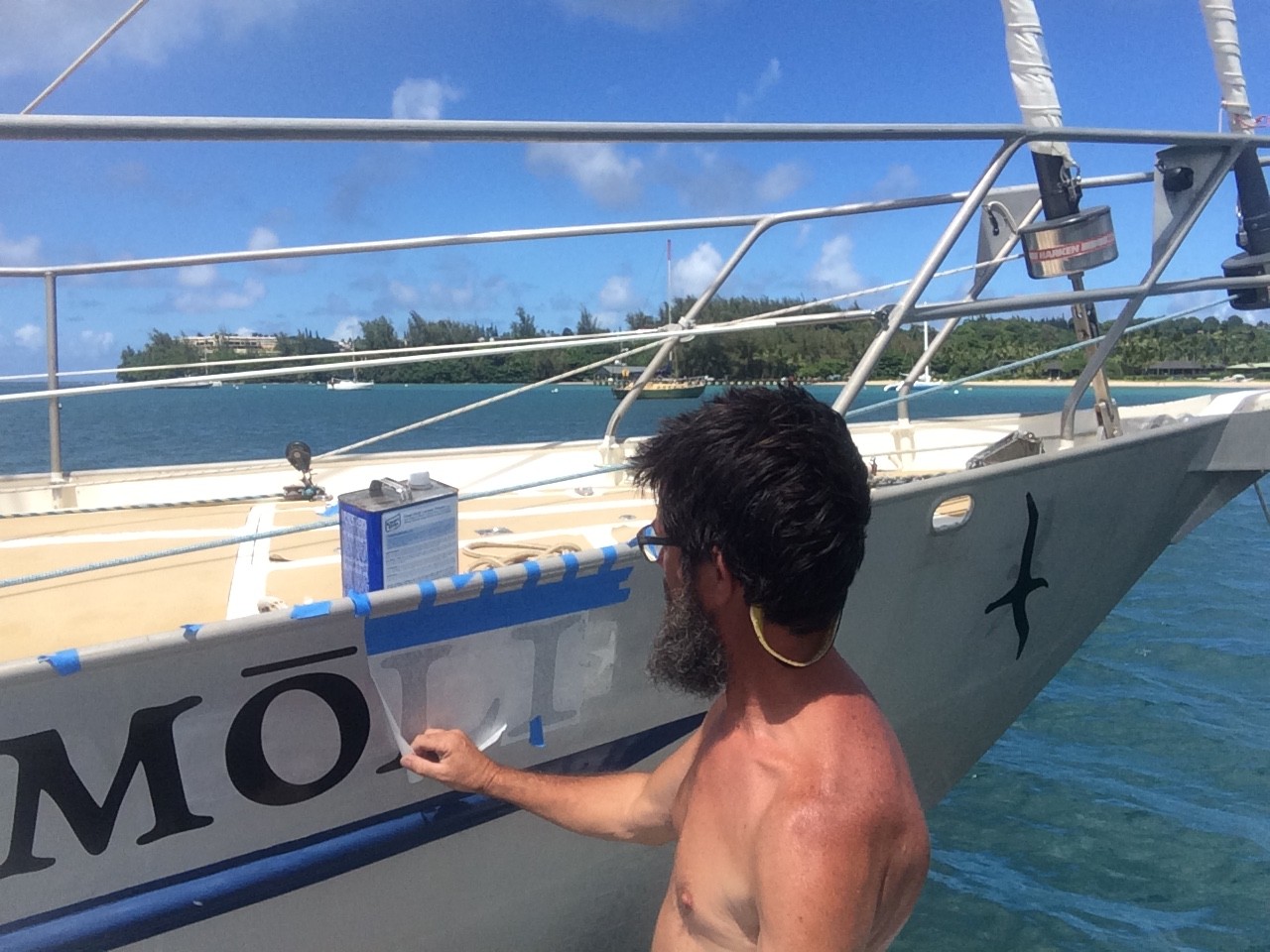
My wife wishes me to point out immediately that MOLI rhymes with HOLY (thus the macron over the “o”) not HOLLY; it is the name that native Hawaiians apply to the Laysan Albatross, which roosts solely in this island chain. Most are partial to the atolls further north, Laysan and Midway, for example, but a growing number are repopulating Kauai.
My choice of landfalls, Kauai’s Hanalei Bay, has not been a random one. In 2005, I joined the crew of COYOTE in Hanalei for my first ocean crossing, a rough-and-tumble, fun-as-hell August slog north to Tofino, BC. In 2012, I launched from here in my own boat, MURRE, to solo all the inhabited Hawaiian islands, this as a last hurrah on a solo of the Pacific; then launched from here again for a solo to Alaska.
In a sense, Hanalei is where it starts for me as a blue water sailor.
Hanalei, or more specifically the windward bluffs nearby Kiluea Point, is also home to one of my favorite pelagics, the MOLI. Anyone who has made a passage north and east over the Pacific High has likely seen this bird soaring in strong winds and big seas with an ease to make a small boat sailor green with envy. These birds are gray bombers; strong and fast, self-assured, wave sailing, ocean marathoning loaners. What’s not to like?

Photo credit, pelagicoddessey.ca
Let’s quickly dispense with the idea that the albatross is a symbol of bad luck. Such an idea likely originates with Coleridge’s Rime of the Ancient Mariner, where a dead albatross wreaks havoc on a ship and its crew. But recall that the sailors aboard that ship, as did sailors of that era generally, thought the albatross a bearer of good luck, and misfortune only ensued when a thoughtless crew member shot a bird flying close astern. More importantly, all it takes is seeing one of these masters in action to know that the superstition is just that.
Some remarks about the albatross to exemplify my admiration, excerpted from Carl Safina’s Eye of the Albatross, noted below.
-During their whole lifespan they expend 95 percent of their existence at sea—flying most of that time. Theirs is a fluid world of wind and wild waters, everything in perpetual motion.
-Land is little more than a necessary inconvenience for breeding…an albatross may make round-trip foraging treks of several thousand miles, sleeping aloft, foraging in darkness and daylight, searching out food enough for a single feeding for their single offspring.
-And so they span long stretches of space and time, distant from any shore, seldom within sight of a coast, embedded in the breeze. Doing so, they cover distances equivalent to flying around the Earth at the equator three times every year. A fifty-year-old albatross has flown, at minimum, 3.7 million miles.
-These creatures are gliding machines. More than anything, albatrosses’ long, narrow wings make them extreme-range mileage mechanisms. The ratio of wingspan to wing width of a Wandering Albatross is 18 to 1, similar to the best-perfected human-made gliders. Their wings’ lift-to-drag ratio—lifting force to air resistance—is a remarkable 40 to 1, more than triple that of many eagles.
-…albatrosses as we know them could only have evolved in the windiest place on Earth—the Southern Ocean, where an abundant supply of moving air breathed creation into Life’s most surpassing capacity for flight.
-Albatross flight looks easy. You have no idea. A Wandering Albatross’s heart actually beats slower during flight than while sitting on the sea. Black-browed Albatrosses use no more energy while flying than when brooding a chick upon their nest…Here’s one of the birds’ secrets: for the long hours and days of flying, albatrosses needn’t really hold their wings out; using an extraordinary wing lock at the shoulder and an elbow lock for rigidity, they snap them into the unfolded position like opened switchblades.
What solo sailor could wish for a better emblem of his aquatic endeavors than an animal completely adapted to, completely comfortable in any weather in any ocean that sailor should choose to explore.
—
If you are the least bit interested in the MOLI, I recommend Carl Safina’s Eye of the Albatross, a life history of mind-bending breadth and depth focused specifically on the Laysan species. Safina’s tale of a single bird, radio tagged and followed throughout the book, is told with tenderness and is packed with detail. This is the grail of albatross books.

Hob Osterlund’s Holy Moli is also well worth exploring. Osterlund founded the Kauai Albatross Network, an organization helping preserve the vitality of the Laysan albatross and promoting safe habitat on the island. Osterlund’s book focuses on the Laysans that roost on Kauai and Midway and is framed as a memoir. Like Safina, her tale is also struck with wonder.

—
But enough about birds. The sail cover is off; the anchor is on short rode; stores (yes, more stores) are stowed; the lee cloth is rigged, the wind is up…

It’s been a month since I arrived in Kauai’s Hanalei Bay. And having, with Joanna at last, enjoyed the island’s green mountains and sweet aroma, it’s time to depart in the morning for home.
Getting back to sea is essentially getting back to work, as these crossings are practice, if you will, for next year’s Figure 8 Voyage; so, before weighing anchor, I thought I’d list a few learnings from the passages to date.
—
1. THIS BOAT CAN MAKE MILES (PHEW!).
One requirement of the Figure 8 is speed. In order to position boat and self for the route’s high latitude weather windows requires an average of about 130 miles a day.
Predicting a potential Figure 8 boat’s abilities in this area was an early challenge I’d solved (partially) by analyzing the average daily miles of boats like Morgan’s AMERICAN PROMISE, Schrader’s RESOURCEFUL, JOSHUA, SUHAILI, GYPSY MOTH, even Rutherford’s ST BRENDAN. The result suggested that about 65% of theoretical hull speed was a reasonable expectation for a heavy displacement cruiser in the 40 foot range when well sailed over a very long, all-weathers course.
This exercise applied to GJOA suggested her 38 foot waterline and theoretical hull speed of 198 miles a day would just make the 130 mile a day requirement.
But with GJOA I had the additional advantage of her history as TAONUI and her non-stop, solo voyage round the world. In 2002, then owner, Tony Gooch, departed Victoria, BC, and completed a 24,249 southern ocean circuit, returning to Victoria after 177 days. Average: 137 miles a day.
This was my expectation upon departing Kodiak.
However, to my great glee, GJOA has handily beaten this expectation on each of her first two (admittedly short) passages. The second, in particular was just flat-out fast. Slowest day: 153 miles. Fastest Day: 177 miles. Average for the 2600 mile course: 159 miles a day.
To be fair, it was a “really fast year” for passages from the mainland to Hawaii, this according the Transpac guys I’ve met. No doubt! We picked up winds of plus 20 knots our second day out of Cape Flattery and held those velocity ranges right on through the whole run.
Moreover, I was really pushing the boat, especially in the first week, and as my friend Gerd Marggraff has said, such high speeds, i.e. near a hull’s maximum, put a lot of strain on boat and crew. Over a longer course, I’ll need to be more conservative in order to avoid injury to either.
So, while I don’t expect to charge through the Figure 8 at 160 miles a day, knowing that I can make or make up such time relieves some of the mileage pressure.
How GJOA performs in lighter winds is unknown to me, but the passage over the North Pacific High to San Francisco will likely shed light here.
2. THE BOAT IS EASY TO HANDLE.
Next to the 30 foot ketch on which I’ve done most of my soloing, GJOA’s 44 foot deck, 62 foot mast and three large working sails were initially daunting, not to mention those two 25 foot genoa poles.
But the rig has turned out to be well-balanced and easy to maintain, with the gear sized to match its power and special thought given to singlehanding by men who are not brutes.
An example: for reefing the main, Tony Gooch removed the standard hook for the reef tack and replaced it with a spring-loaded clip. Through the tack is rove six inches of two-inch webbing with a ring on each end. The webbing is long enough to be grabbed easily and solidly by the hand that’s not managing the main halyard, and the clip locks the ring in place. No more fighting to get the tack on the hook only to have it slip off before the reefed sail can be raised!

Another example is the boat’s double headsail configuration. Though raising and lowering the genoa poles does take some planning (see previous post), and getting them aligned correctly, some practice, their permanent connection to a long mast track, their light weight and three simple, pre-rigged control lines make them easy to tame (the one exception being that moment between getting the pole over the rail and clipping the sheet into its slot). This allows exceptional control of two very powerful sails, all from the cockpit, control which allows the sails to be flown longer in increasing winds and over a large range of wind direction.
Many other examples we can save for later.
All in all, I’ve found GJOA easier to handle than I had anticipated.
3. SYSTEMS SIMPLICITY IS A REAL BENEFIT.
Thoughtfulness like the above is as evident in what the boat does not have as in what she does. No refrigerator, no freezer, no water maker, no electrical galley pumps, no electrical bilge pumps all have significantly reduce maintenance work and worry, not to mention eliminating the complication of having to power them while under sail.
(GJOA has solved the water problem for the singlehander by carrying nearly 200 gallons in two integral keel tanks.)
On a related note, I’ve been pleased by the ease with which the 300 watts of solar power added in Homer has been able to keep up with the boat’s admittedly minimal electrical requirements. Weather between Cape Flattery and Kauai, being either totally socked in or squally, was not ideal for solar power generation, but I found that one good afternoon of sun every day or two was enough to top off the tanks, and for the most part, that’s what we got.
Granted, GJOAs current requirements are low. A chartplotter (screen turned down), VHF radio, AIS transmitter, and the Iridium GO! are on 24/7; the iPad is typically charged once a day, LED running lights are lit after dark, and one LED cabin light gets some use. That’s about it. So, not surprisingly, the largest deficit the panels had to make up on the whole passage was 54 amps in a 450 amp system. Not a tall order for 300 watts on a day with any sun.
4. I’M STILL LEARNING TO ADAPT TO LIFE BELOW DECKS.
Comfort, where such is meant to indicate convenience and ease, “should not be expected” from a small boat upon a big ocean, and any complaint speaks more to my failure to adapt than a failing of the boat.
Still, my now common joke regarding GJOA’s below decks is that, for a German luxury yacht, “she’s a bit Martin Luther.” Her seat-backs in the main salon are straight up and down, disallowing any posture but the most pious. Add that there’s no obvious place to sit in the pilot house except atop the two long, teak cabinets that run down either side. Back rests that once fit the aft-most sections of these cabinets have long since been removed, as have their cushions, making them, as instruments of repose, about as relaxing as an oaken pew.
(I’ve provisionally replaced the seat-backs and cushions before the trip home.)
The galley sink, being well off to port, tends to take on water if the boat is on starboard tack or it fills and empties as one rolls when running in a seaway. Initially I thought this a disadvantage and even for a time, when on such tacks, I took to shutting off the sink drain valve and moving my dishwashing to a bucket in the cockpit. But further experimentation has shown that breakfast dishes left in the sink on a morning of heavy downwind sailing (emphasis on downwind) will be thoroughly cleaned by lunch time from the continual rinsing. Score one for adaptation.
5. THE RIGHT STUFF IS BREAKING.
Of all the issues encountered to date, I’m most happy that the steering problems arose before the Figure 8. Issues here include malfunctions in the autopilot and the windvane, both induced through generous applications of owner absent-mindedness.
On the approach to Cape Flattery, the autopilot failed. The symptoms were complicated, but the cause was quite simple: I allowed the hydraulic fluid reservoir to run dry. Learning: check the damned thing!
And the massive chafe on the Monitor during the run to Kauai was caused by a frozen block right off the tiller line (replaced while underway). As it turns out, the strain this generated also wore the lower block on the Monitor, so all have been checked and two replaced as have been the tiller lines (again). At this point the only original item on the Monitor is the stainless tubing.

Other failures have included a genoa pole car that split, spilling its bearings, when put under too much load by the captain, one genoa wrapped nearly to death (sheet cut) in a yachtsman’s gale off Port Angeles, one dead starter switch (both replaced), a burned up engine bilge pump impeller (also replaced).
All in all, I’m learning quite a bit about managing Gjoa while underway.

For the humor file, the following…
I’ve begun to shoot passage video. No talkies yet. That takes a fortitude I’ve yet to muster. But action shots. Reefing sail. Cranking in. Not falling overboard. Harpooning the Great White Whale. The like.
To a one, they are awful.
I attempt to channel Sterling Hayden; I’d even settle for H. W. Tillman. The camera, however, refuses to film anything but a diffident bank teller, heavily bearded, who finds himself mysteriously teleported to the foredeck of a sailboat in mid ocean. His ignorance is complete; his awkwardness, without peer.
Thus the videos are not to be had. That said, my first attempt has been excerpted here due to its being an excellent tutorial upon the lofting of a genoa pole.
I will say in my defense that by this time I’ve swung the poles a dozen times or more, and not even the first went like this. What’s really on display, my argument will continue, is an introvert’s natural aversion to being filmed, even when the camera is his own and there isn’t another soul within a thousand miles.
But judge for yourself.
LESSON ONE: First loosen the green line. Which green line? The green one. But there are three.

LESSON TWO: It is suggested that while upon the foredeck, one will, at all times, hold on with both hands.

LESSON THREE: Clip the genoa sheet into the pole socket…while holding on with both hands.

LESSON FOUR: Haul Away!

LESSON FIVE: However, while hauling, it is best not to let go of the green line, any of them, as the pole my come crashing from the sky.

LESSON SIX: Having swung the pole, admire your handy work…especially that most clever after guy.
Regarding that last shot, and for those unfamiliar with this operation, all lines must go outside of everything. In fact, I have a mantra I repeat while attaching the lines, simply “Remember, Outside of Everything.”
So, how then, if concentrating so hard on that one move, could I have managed to get the after guy (line in the bottom right hand corner) INSIDE of the rail?
This mistake requires the whole rig come down and the procedure to be done again.
Good job I’m alone and off where no one can see my mistakes.

Not the most picturesque of approaches. The island is blanketed in cloud. Rain. The bay water is brown from run-off. Ex-Howard is passing through.
But we’ve arrived.
Departed Neah Bay, Washington 7/22/16, 10:20am.
Anchored Hanalie Bay, Kauai, 8/7/16, 4:50pm
Total Miles: 2585
Duration: 16 days, 6 hours
Miles per Day: 159 (fast!)
Many thanks to Kylie Teele for her help in posting my daily blogs. I send her photos (one per email, and each takes 15 minutes to transmit over the GO!) and my ramblings, and she compiles all onto this site…seven days a week. Well done.
Also to friend, Jim Walter, for helping me with weather information W of 140W. I couldn’t get Saildocs to work for this region, and so would have been flying blind without his assistance.
A beer, some clean up, and some non-timed sleep.

Na Pali Coast appears briefly from beneath the cloud.

Quite literally the last beer aboard. And it happens to be Alaskan! Seems fitting.

August 7
Cape Flattery to Kauai
Day 16
Noon PST position: 22.29.61N by 159.03.30W
Miles since last noon: 167
Total miles of passage: 2532 / 30 to Kauai
Avg. Miles per Day: 158
Course: SW
Speed: 6 and 7 knots
Wind: ENE 15 to 20
Sky: Rain squall, one after the other
Waves: ENE 5-7
Bar: 1011
Air Temperature: 81 degrees
Sea Temperature: 79 degrees
A clear and starry sky. Wind, its usual fresh self. Our progress, excellent. Maybe we’ve got ahead of Ex-Howard, I thought. Or he’s blown beyond?
3am. I woke to rain, that hot hurricane smell*, and a pilot house full of water. I’d left the hatch open (See reference to stars), which a passing squall could not resist. Mopped up. Went back to my bunk. Woke next hour to find the pilot house full of water. I’d left the hatch open. Another squall. Mopped up. Did that THREE times before remembering to CLOSE the hatch after the mopping exercise. Pilot house now cleaner than it has been in weeks.
Daylight showed the sky not as terrible as it had felt. It is eery to have it so dark you see nothing, not even whitecaps, so drizzly the dull cone of your headlamp penetrates a mere foot or two before giving up. Without evidence to the contrary, you imagine apocalypse. Dawn is greatly anticipated.
And this dawn showed a lower and grayer version of more-of-same.
My barometer read 1011. I’d calibrated in Kodiak. Am presuming at 1011 I’m near Howard’s center of 1013! Or maybe I’ve trespassed into the Holy of Holies. 1011 is lowest I’ve had by far. The barometer has been hovering at 1015 to 1013 for a couple days. 1019 to 1022 were previous trade wind norms.
Winds now are really the same they’ve been for days, too. There was more NE in them overnight, but there’s more E in them now, and velocities are in the high teens, low 20s. The NE winds took me off south overnight, which I wanted due to SE winds predicted for close in (looks like SE won’t be in the cards for the N island areas…ok w/me), but have not been able to hold onto the southing. Am more or less back on my rhumb line course.
Somehow I magicked into the perfect set of sail at yesterday’s dusk. Made 6.7 knots overnight, and though I adjusted course several times, I never touched the set. Must be picking up a beneficial current too; the wake I make is just not going that fast.
Biggest concern now is to get lined up for entrance. Don’t want to be swept past. Don’t want to turn the North Shore into a lee shore.
30 miles to go.
Three boobies headed into the wind, one a blue footed; two were juveniles I couldn’t identify. One Frigate gliding high. Oh yes, I’d forgotten about them.
No sight of land. Drenching squall after drenching squall today. Not expecting land ho until I’m upon it.
—
*never been in a hurricane, but I’ve got a whiff a few times on this passage when the dark rain cell that passes over you is actually hotter and and muggier than the clear tropical sky it covered.

August 6
Cape Flattery to Kauai
Day 15
Noon PST position: 23.57.34N by 156.36.99W
Miles since last noon: 158
Total miles of passage: 2365 / 190 to Kauai
Avg. Miles per Day: 158
Course: SW
Speed: 6 and 7 knots
Wind: ENE 15 to 20
Sky: Tropical Cumulus in afternoon; next morning numerous squalls
Waves: ENE 5-7
Bar: 1014
Air Temperature: 81 degrees
Sea Temperature: 78 degrees
A fast afternoon yesterday as the sky cleared and the wind settled in at 20 plus from its usual ENE. Hour after hour we ticked off 7 nautical miles toward the goal.
As I’ve now come to expect, a planetary-sized wall of cloud approached as the sun set, and by dark we were in pea soup again. I reduced sail by half when I began my sleep cycle at 11pm in anticipation of variable winds and squally weather overnight.
Instead wind eased to sub 15 and stayed pretty consistent; by 2am we were back to just a small tuck in the twins and around 6 knots of boat speed.
—
This morning, however, has been tiring.
Low-Formerly-Known-As-Howard continues his slow approach, and so unsettled, wet, variable-wind weather becomes more and more dominant. Today’s episode included squall after squall in rapid succession; literally, five minutes of fast wind from the NE as the squall arrived, 15 minutes of zero viz, rain and light winds as it passed over followed by 15 minutes of an open sky and winds plus 20 knots. Rinse and repeat.
All this kept me in the cockpit trimming sail from first light until the sun rose high enough to burn off the small-fry squalls and even out the day; i.e. about noon. Now we’re getting a big squall every hour or two.
I had wanted one more 160 mile day before we end this passage, but the squalls won and I’ll have to settle for a solid 158.
This puts us at 190 miles to Hanalie Bay, and likely an evening approach tomorrow. I’ve given up on a “cruise ship” arrival–views of the Na Pali Coast at sunset, etc.; unsettled, wet weather is due to peak as we get close, but I would like to get in before dark. As all this Howard nonsense meets the land, it’s sure to kick up something unexpected, which I’d like to be able to see.
—
Eight flying fish dead on deck this morning. Could someone please send a memo to the International Council of Flying Fish saying that the big black hulk that looks like an upside down Killer Whale enroute Hawaii is *only dangerous if you run away.*
—
New birds: Sooty Terns, a three-some headed NE (dark above, light below, swallow tail, swooping, off-the-water flight) and then what I think were two all-dark juveniles who played at mast top for a few minutes. Then there’s a brown-above-and-light-below petrel I’ve not been able to identify. He drifts at wave-top, moving about softly, privately, and with none of that demonic power and rocket speed of the Gadfly.
One Tropic Bird today. Quite miffed was he that I’d tossed the unfortunate flying fish overboard.
No Boobies yet. No Noddies. No Layson’s Albatross. No Blackfooted Albatross for a week. Where is everybody?
—
Aha, just now a squall with enough rain that I stripped down and got a cooling soak. Nearly a proper shower.
Now to post this and begin thinking about dinner.

First light saw the ragged cloud at the top of this post and ten minutes later, a clearer view like this. The rest of the day has been that variable and wet.

Surprising how much time a solo sailor running before the wind spends looking backwards. Looking at the windvane (his vital crewmember) to see how he’s doing. Looking at the approaching sky to see if there’s anything to worry about. Why look forward? That’s where you’ve already been.

No time to cook lunch today. Eat Ravs cold from the can. This is my quick/comfort food. Never had them hot. Are they tasty that way?

Glasses: what people wear who are committed to never seeing the world clearly again.

August 5
Cape Flattery to Kauai
Day 14
Noon PST position: 25.19.96N by 154.19.13W
Miles since last noon: 153
Total miles of passage: 2207 / 340 to Kauai
Avg. Miles per Day: 158
Course: SW
Speed: 6 and 7 knots
Wind: ENE 15 to around 30, strongest overnight
Sky: Tropical Cumulus, wall of squall at sunset, rain, then clear until dawn
Waves: ENE 5-8
Bar: 1016
Air Temperature: 81 degrees
Sea Temperature: 78 degrees
Quintessential trade wind day. Cottony or towering cumulus, powdery blue sky, sapphire waves, wind in the 20s. Tropic Birds, Gadfly Petrels. Flying fish scattering in schools like silvery birds flushed from blue grass.
In late afternoon approached a wall of cloud covering the entire upwind horizon; torn at the top, lead gray below and heavy with possibility, none of it good.
Aha, I thought, here is the leading edge of low-formerly-known-as-Howard (in meteorology, if you lose your virility, people stop calling you by your name).
By dusk it was upon us. Wind went soft. Great war elephants of cloud marched forward dropping their rain in thick columns. Some missed us; some were a direct hit. I closed the hatches, went below and made dinner.
On deck in late evening I saw that the front had passed. Not a cloud. Instead stars to sea-top in all directions. Behind the front, wind filled in to 30 knots and blew like that all night. Thus our pretty good day’s run.
—
Note drop in barometer over last two days from 1020 (noon, 8/3) to 1015 (2pm today). Low-formerly-known-as-Howard has a center of 1013, winds to 30 knots and is traveling west at about 13 miles per hour. Far as I can tell, we will arrive at Kauai at about the same time.
—
Cook: Who ate the last of the cookies?
Purser: The cookies are gone? All gone? I stocked entire truck loads of cookies. Didn’t you ration them?
Cook: Who the hell rations cookies?
Purser: Those who might run out of them, that’s who.
Cook: Well, it’s too late. They’re gone and the crew is pounding the table. Hear?
Luckily, Captain Cranky discovered a bottle of Nutella in his private stock and the cook found a loaf of bread that, amazingly, hadn’t a spot of mold on it. He said it was a miracle, a sure sign of a lucky voyage when the bread didn’t go stale. Captain Cranky made gift of his sole bottle of Nutella “to the health of the crew,” and all were happy.

How quickly our wake is absorbed back into the blue. Not even ten boat lengths and any evidence we were here simply vanishes, the only evidence to begin with being pale foam.

The cookies, it has been discovered, are all gone. Luckily, we have a jar of this!

August 4
Cape Flattery to Kauai
Day 13
Noon PST position: 26.42.79 by 151.58.53W
Miles since last noon: 139
Total miles of passage: 2054 / 491 to Kauai
Avg. Miles per Day: 139
Course: SW
Speed: 5 – 6
Wind: ENE 15 to 25, very light overnight
Sky: Tropical Cumulus, occasional squall with some higher stratus, but mostly sun
Waves: ENE 5-7
Bar: 1018
Air Temperature: 81 degrees
Sea Temperature: 77 degrees
My spirits are up and down based on how fast we go. The sea is its stunning self, electric sapphire blue, undulating infinitely, breaking with foam an indescribable white. But I see none of it if we aren’t hauling ass.
Yesterday afternoon I trimmed the twins, the big jenny on starboard about 1/2 to 2/3rds open and the the working jib to port about 1/3rd less. Both were set to take wind over the starboard quarter. I gave Otto a reprieve about 2pm, and Monte Cristo steered the afternoon and into the evening without complaint. Our speed was a steady 6.5 knots and I felt our progress good. I felt good.
I reduced sail slightly before starting my sleep cycle.
Over night winds went light again (thus the poor daily total). Heavy, low cloud moved in with a cloying mist. In the wee hours Monte lost his touch and we swung slowly west, just like the night before.
I rose early, uncomfortable and worried–first Howard and now Isabelle–but determined not to lose a mile more.
Two hours before light. Within the beam of a headlamp I pulled the poles and set the big jenny for a reach. Got four knots and a lousy shape. I moved the working jib over. Better. I made coffee … and by that time the day’s ENE trades set in. After coffee and a pastry, I re-swung the poles and let fly the sails and we went sailing SW like we’ve been doing for days now.
Gradually I suss that the trades’ diurnal rhythm.
Today, same pattern. Good time under the big genoa alone at first (experiment) and now the twins. Last two hours, 13 miles. I am happy. But what to do about tonight? May purposefully head off west and come back in tomorrow under main and working jib.
—
With wind velocities up and down and me often driving the boat pretty hard, I’ve been spending a lot of time on deck and at the winches taking in or letting out sail area. So much so that I’ve nom de plumed myself Capt. Cranky, who wrote a ditty.
*Capt. Cranky’s Winch Ditty*
If your soul is weary and your flesh is weak
Crank a winch
If the hour is nigh but before its peak
Crank a winch
If wind goes South then West then East
Crank a winch
If your coffee is hot
Crank a winch
If your bunk, is not
Crank a winch
If your arms are wobbly and your joints do creak
Crank a winch
If the heart says “courage” but the mind says “freak”
Crank a winch
When in the midst of taking a leak
Crank a winch
If on deck
Crank a winch
When dinner’s ate
Crank a winch
If below
Crank a winch
When dreams let go
Morning, noon, and the dark of night
Crank a winch
Whether or not
Crank a winch
Winch winch winch winch, winch winch winch
Crank a winch


August 3
Cape Flattery to Kauai
Day 12
Noon PST position: 27.51.83N by 149.50.01W
Miles since last noon: 153
Total miles of passage: 1915 / 624 to Kauai
Avg. Miles per Day: 160
Course: SW
Speed: 6
Wind: ENE 15 to 25
Sky: Tropical Cumulus, occasional squall
Waves: ENE 5-7
Bar: 1020
Air Temperature: 79 degrees
Sea Temperature: 76 degrees
I now understand why Moitessier made the Tropic Bird his avatar in *The Long Way*. The piece of ocean where he received so much companionship must have been similar to mine, as several daily and much anticipated visits are now my norm.
They usually occur in the morning.
And we’ve begun to converse.
Randall: Good morning, my friend. It is a great pleasure to see you. It pains me to tell you that I still have no fish. Please accept my greatest apologies, and feel free to check back tomorrow.
Tropic Bird: Squawk. (Flies off.)
For I have sussed what they are after. They’ve seen the flying fish on my decks. They’ve made a connection, thus far unproductive for them.
(Lovely bird, but I suspect that an infinite number of Tropic Birds wouldn’t get any nearer to *Hamlet* than an infinite number of squawks.)
—
Slept fitfully through the last two one-hour cycles and ended the last prematurely. The night had been thick, heavy with cloud and muggy. Even with but a sheet I was clammy in the lee cloth. Clammy and worried.
In the wee hours the wind went soft and I’d let us drift off to the west rather than do the work required–that might include finally taking down the poles–to get us back on course. I wanted to sleep. And dark was complete; I couldn’t see the deck much less the sails. One more hour. Ten miles west won’t count much against the required 600 southwest.
But then there’s this Howard and his distant cousin I need to stay ahead of. This is not the season for dawdling here.
At first light I found my seat next to Monte (the wind vane) intending to reintroduce the idea of southing into a conversation that had begun to feel more like a therapy session than a directive on direction-keeping.
“So, when was it you realized you were afraid of going south?”
I reached for his adjustor, but noticed an odd lay to the starboard tiller line. The cover gathered up like a worm near the bowline, and when I looked over the dorade vent, I could see that it had worn away entirely leaving two feet of bare core, which itself was already fraying.
Even before coffee, this!
I had checked here for chafe a mere 24 hours earlier. The line gently touches the ring of the dorade and cockpit coaming–on both sides–but neither had produced any evidence of chafe the whole passage. I felt the dorade ring again. Nothing sharp.
What is it with Monte that he must chew through so much goddamned line?
I switched on Otto (autopilot) and had a new (old blue Amsteel) line rove within the hour (getting lots of practice there, at least). But I left Otto on until late afternoon, this by way of letting Monte know he’s not the only game in town.
I also taped up the dorade touch point.
Part of my bafflement is that I used the same unit on Murre, and in 15,000 miles and three long passages, I never had to renew the tiller lines. So, the issues must be unique to this install…or its user…but how?
—
Am now shirtless, in shorts, and rubber boots. I have all the color of a flayed Halibut and as much muscle tone. I’ve spared you the photo.

Shout out to the guys at Admiralty Ship Supply, THE chandler in Port Townsend. Thanks again for the red shirt, which I donned yesterday for my birthday party (consisting of a beer on the veranda). It’s my last clean shirt and quite comfortable.

Photo of chafe on starboard tiller line from this morning. Had worn down to the core, and that too was wearing.

August 2
Cape Flattery to Kauai
Day 11
Noon PST position: 28.51.21N by 14.20.32W
Miles since last noon: 155
Total miles of passage: 1762
Avg. Miles per Day: 160
Course: SW (mostly)
Speed: 6+
Wind: ENE 15 to 20
Sky: Cumulus, occasional squall
Waves: ENE 5-7
Bar: 1019
Air Temperature: 79 degrees
Sea Temperature: 74 degrees (Note jump from yesterday of 4 degrees)
A lesson in going about your business, even when such is absurd: I found a tiny spider building a web on the *outside* of the pilot house today. He was on starboard, so had a slight lee in his favor, but still, the infant web of the infant spider was being buffeted by the wind, requiring more persistence in the construction process than I have seen in any other creature. And all for naught. There’s not a thing for him to eat out here. In fact, how he *got here* is a mystery. When I looked ten minutes later, spider and web had been blown away.
—
Today I’ve been preparing for Howard’s visit.
Howard is a Tropical Storm that was, this morning, positioned at 18N by 127W. It’s moving WNW at 15 knots and is making a beeline for my estimated Thursday position. It’s not, thus far, forecast to be a storm by that time, but merely a “remnant low.” However, appended to that remark in this morning’s forecast was, “…with likely gale force winds.”
That got my attention.
Other bulletins forwarded by my friend, Jim Walter, throughout the day suggest the chances of winds over 34 knots are in single and low double digits. And besides, I can probably run with the twins in winds to 40 knots.
Still, I’ve used it as an excuse to get ready for some heavier weather. I’ve moved the fenders chockablocking the anchor locker (where the storm sail is stowed) to the fo’c’sle. It’s a testament to how boisterous our weather is already that the first fender leapt into the sea (free, free at last!) before I knew what had happened. The others had to be lifted from the locker, lashed on deck; then unlashed when I’d climbed from the locker and was ready to transport them below.
The storm sail is out and rigged for action; the ugly Jerry cans on deck have been put into the anchor locker along with the jug of gas for the generator. The spare propane tank has been moved from its awkward stern location and is lashed in the cockpit well. And lashings have been prepared to hold the solar panels in a down/locked position.
Notice a pattern?
Upshot: the deck has been cleared and is ready for action.
That may not sound like much, but when you work with one hand–the other holding on–even the smallest projects take forever.
—
We had settled weather and lighter, steadier winds overnight and until about noon when a squally sky returned and brought back the 25 to 15 to 20 pattern. Still making very good time, if less gently.
—
Today is my birthday. I am 54 years old. I think I’ve been at sea on my birthday four years of the last six, which makes it very difficult for someone to bake you a cake. My own celebration has been simple. I took a bath and put on a red shirt, the last clean one in stock.

None of the harnesses aboard had “crotch straps,” without which the harness is likely to be stripped off your body if you fall overboard. This one I jury rigged from the galley safety strap and some spare clips.

I guess I’ve not visited the foredeck in a while. Found this guy today and it looks like he’s been sunning there for some time.

August 1
Cape Flattery to Kauai
Day 10
Noon PST position: 30.02.40N by 144.54.89W
Miles since last noon: 162
Total miles of passage: 1607
Avg. Miles per Day: 161
Course: SW
Speed: 6 – 7
Wind: ENE to E 10 to 25
Sky: Squally; solidly gray otherwise; some clearing in afternoon
Waves: ENE 5, N10
Bar: 1019
Air Temperature: 77 degrees
Sea Temperature: 70 degrees
Squally still and with strong but inconsistent winds. Up to 30 knots on the front side of two wet ones today; 10 – 15 knots inside and then the usual 20 plus on the back end. As the wind is up and down, so I am on deck frequently cranking in and cranking out sail.
If asked, I’d admit to being a bit fatigued. But am “happy” to get this kind of work out. Am learning a tremendous amount, even if I couldn’t articulate much of it just now.
Balancing the twin’s sail area and attitude to what the boat can handle is more challenging than I would have thought. The boat is so strong, it’s hard for me to tell when she’s over-canvased…except that the vane goes pie-eyed and start’s steering an extreme S shaped course. That’s her plea for help.
The lumpy-as-all-hell sea doesn’t make for easy steering either. The background swell is an infrequent N10 and must be from the strong winds of the coast of California. The local stuff from the ENE is just a mess. No regularity; not large, but steep and often breaking. Tends to knock the stern around. And (I think) may throw the wind vane a curve ball (restricts her access to clean wind) as it piles up, lifts the boat and then drops her down. Just a theory.
By this time, I’ve tried every conceivable sail configuration, some quite ugly: same sail area side to side; vastly different; sheeted in hard, let belly out. But the Buddha has yet to drop his here’s-how-to-do-8-knots-
Mixed in with the infernal gray sky are quintessentially tropical cumulus towers. That’s new. So there’s hope for some sun, someday, or at least something steady.
Third day in a t-shirt. First day barefooted. Almost time to find the short pants.
Current predictions call for now Tropical Storm Howard to be but a remnant low by the time he gets to our position. May that prediction hold.
And now the wind is down to 12 from 25 plus. We wallow and forget our course. Time to be on deck.

One of my uglier combinations. Working jib reefed in but bellied out to port (partly to ease our rolling) and the genoa out fuller, but sheeted in to starboard as wind is on port quarter.

This shot of the chart plotter shows my course upper left, and my plot of TS Howard as he’s been developing and making way NW.

July 31
Cape Flattery to Kauai
Day 9
Noon PST position: 31.17.25N by 142.17.04W
Miles since last noon: 153
Total miles of passage: 1445
Avg. Miles per Day: 160
Course: SW
Speed: 5+ knots overnight; higher today.
Wind: ENE 10 to 20 (diminished overnight; has filled in today)
Sky: Squally, broken sky. Partly sunny.
Waves: NE 4
Bar: 1019
Air Temperature: 77 degrees
Sea Temperature: 69 degrees
Light wind overnight produced our “slowest” day of the passage. But if “slow” is over 6 knots, I’ll take it.
Been on deck most of today. The wind has gone more east than suits me for a run dead down wind.
But putting the wind a few degrees on the port quarter required shifting the headsails to opposite sides, the big genoa to starboard and the working jib to port and canted forward a tad.
That operation took an hour (I’m still very slow at foredeck ops). And then another hour to trim the sails to my liking. And then another hour to “tune” the wind vane to an unusual and difficult course. All complicated by wind that was up and down between 10 and 20 depending on our proximity to the next squall.
I’m ready for a beer.
Several rain showers today, light and misty. Cooling. After my winter and spring in Homer, temperatures are already beginning to feel hot. All the ports are open. The Dorade vents too.
Tropic birds again. All white tailed. And two black footed albatross. A fast flier that I think is a gadly petrel, but it never came close enough to tell. I’m disappointed by the lack of birdlife on this run.
By way of solving the veg-going-off problem, yesterday I cooked all of it into a big (2 gallon) pot of ragout–all the bell peppers, all the zucchini, all the tomatoes, plus garlic, onions, herb mix, chicken stock, and butter. That became the base for pasta sauce with beef, last night’s dinner. Tonight it will be the base for a chicken curry with rice. Looking forward to it.
Sadly, I think the bread is going over the side today. Upside: now I get to try the Pilot Crackers. Downside: I can’t imagine they’re much to write home about.
Been monitoring an International Harvester about to come off the line south of Cabo. Not ideal timing. At present course and speed, we’re still 7 days out from Hanalie Bay. But we have a good head start. Not much more to be said until it makes its intentions clear.

July 30
Cape Flattery to Kauai
Day 8
Noon PST position: 32.27.95N by 139.45.48W
Miles since last noon: 161
Total miles of passage: 1292
Avg. Miles per Day: 162
Course: SW
Speed: 6+ knots, but dropping
Wind: NE 10 to 20 (diminished overnight; has been lighter all day)
Sky: Solid deck, low and oppressive.
Waves: NE 4
Bar: 1020
Air Temperature: 72 degrees
Sea Temperature: 68 degrees
For those of you playing the Halfway-to-Hawaii game, the answer is…we passed it today. I’ve drawn a rum line course on the chart, not that I’m following it exactly, which shows 1215 miles remaining.
We’ve been running dead downwind since yesterday afternoon and making good a meandering SW course. There’s a single reef in the working jib and an equivalent amount of sail out in the genoa.
Stars overnight. Again, the hope that we’d sailed out from under this everlasting gray.
But when I stopped my sleep cycle at 7am, cloud had moved in so thickly it was still too dark to write in the logbook without a flashlight. An hour later I could see the definition of the sky, and if I weren’t sure I was in the middle of an ocean, I’d say I was in Kansas in summer.
Low, oppressive, tornado-alley cloud, often jagged on the underside. I studied these extensions, these often sharp fingers pointing seaward and could watch them form and dissipate and twice even saw rotation. I swear. Small twisters in the making? I know–the temperatures are barely 70 degrees.
White Tailed Tropic Birds have been our mates all morning. Twice, a pair of them. One attempted to land on the mast top, but found it too much a moving target. Not sure if I’m seeing the same birds or different individuals passing through, but have had six our eight sightings since coming on deck.
The frayed wind vane tiller line continues to fray for no reason that I can figure. I’ll have to change it tomorrow. But in good news, I’ve switched to a light-wind air vane and that has stopped most of our wicked “S” curving over the ocean (if in doubt, read the manual).
Of Food…
Opened the last of the Homer-era coffee today. In the Anchorage Costco, this back on May 5th, I bought two large (3lb) bags of freshly roasted French and vacuum packed them into nine 3 cup bags (the size of my galley coffee can). That batch has lasted three months, nearly. It takes 8 days or so for me to use 3 cups of grounds. (Two 32oz bags purchased later remain in stock).
A 12.6 oz can of NIDO powdered milk, used almost exclusively as coffee creamer, lasts two weeks. (I still have 6 cans aboard).
I’m down to 13 cans of beer … but haven’t touched the ample supply of wine as yet.
I’m cooking less than I anticipated, opting, in boisterous weather, to open a can of raviolis or lentils or other soup. I’ve eaten cold 8 cans of lentil soup (26 remain) and 3 cans of raviolis (10 remain).
Of stewed tomatoes, a staple for stews, I’ve used 9 cans (37 remain).
I’ve barely touched the dried legumes (have used only one 1lb bag of lentils) or the grains like Quinoa (four 2 lb bags remain), the brown rice (have used 6 cups of a 15lb bag), and I’ve eaten through only 18 cans of canned meat (beef, pork, chicken, salmon, tuna), leaving 66 in stock.
Which is to say, I’m loaded with good food.
I’m out of tortilla chips and am low on cookies, however.
In other food news, my nets of fresh vegetables (zucchini, roma tomatoes, mini bell peppers, cabbage), even my bread, are feeling the heat. All are going off at once. I bought three loves of bread in Port Townsend and the two remaining are getting green.
Moreover, my success with “spreadable” butter (butter blended with canola oil) on the Kodiak to Cape Flattery run has failed this leg. Too warm. It’s separating and liquifying. Interestingly, the Ghee purchased in Homer is holding up better–has the consistency of ketchup. But it has developed a salty odor reminiscent of parmesan cheese. This seems not to have effected its edibility, just its delectability.


July 29
Cape Flattery to Kauai
Day 7
Noon PST position: 34.02.62N by 137.20.34W
Miles since last noon: 171
Total miles of passage: 1131
Avg. Miles per Day: 162
Course: SW
Speed: 7 knots
Wind: NNE 10 to 20 (still, periods of 10 – 15, then periods of 15 – 20+. Pulsing)
Sky: Solid deck, low and oppressive. Think Miami in summer without the heat.
Waves: NNE 5-7
Bar: 1021
Air Temperature: 73 degrees
Sea Temperature: 66 degrees
Today has been dedicated to the steering system. Over the last couple day’s I’ve noticed a deep rumbling coming from astern when the tiller turns a certain way. The tambour is suggestive of something large and heavy, like the rudder vibrating in its shoe.
It was nothing of the sort. Instead the thunder-box culprit was one of the small turning blocks that leads the wind vane tiller line back to the vane itself.
Assuming the complainer had salt encrusted bearings, I gave it a bath of fresh water and went to examine its brother block. This one was frozen altogether! How long had the line been passing back and forth without the expected assistance? I shudder to think! And this discovery may explain what I sense has been the Monitor’s tendency to over correct…due to its taking so much pressure to correct in the first place.
My friend David R Kelton recently lent me a German phrase for such moments. That is, when, after lavishing hours upon the refurbishment of your wind vane, your improvement fails because you forgot to refurbish, nay, even examine, a related item, the appropriate phrase is Pech Haben Wir. Said casually, it’s pronounced, “Pech Hammer!” and is followed by a slamming of the fist onto a nearby counter. Translation: “what tough luck we’re having!”
Actually, in these exact circumstances, Dr. Kelton may substitute a more appropriate German phrase translating roughly to “Stupid Head!”
With some work, I got both blocks turning quietly yesterday, but when I examined them first thing this morning, the complainer was complaining (actually leaking a black gook) and the freezer was froze. Worse, the starboard line where it enters the Monitor was almost chafed through!
I regularly check for chafe on these lines. Yes, there had been some here in days past, but some fuzzing of the line cover is normal at these turning blocks (in my experience). THIS however, was frighteningly abnormal.
Unfortunately I don’t have a selection of small blocks aboard, so had to pilfer two larger blocks from the headsail outhaul lines. That was it’s own operation.
Then on went the autopilot and apart came the Monitor. The only worrisome task was leaning over the stern, the boat going 7 knots, in order to pull through the new line (from the excess of line left at the tiller end for just such a happenstance).
The Monitor was back in action by noon.
But I don’t think I’ve solved the massive chafe issue of that starboard line. It’s already fuzzing. I’ve checked the entrance block adjustment; I’ve bent out of the way the entrance flange (just in case); I’ve checked that both blocks turn freely (they do). So, at moment, I’m mystified.
This line was newly installed in Neah Bay. So the chafe is inversely aggressive to the obviousness of its source.
—
Two tropic birds today. Both approached close to the boat. A few blackfooted albatross. Maybe a gadfly petrel. ONE flying fish…flying. There continues to be not much going on in this quadrant of the ocean.
I checked my hoochie this afternoon, and it had been bitten off at the lead. No fish this trip.
More plastic, usually large, broken and unrecognizable pieces. One or two per minute if you look hard.

The old, frayed line is refreshed by pulling new line down and through the Monitor. Bracing with the boat doing 7 knots.

This is the starboard tiller line and where it enters the wind vane on the port side. The cover is entirely worn off.

The smaller, failed blocks and one of the replacements.

July 28
Cape Flattery to Kauai
Day 6
Noon position: 35.50.44N by 135.54.80W
Miles since last noon: 174
Total miles of passage: 960
Avg. Miles per Day: 160
Course: WSW
Speed: 7 knots
Wind: NNE 10 to 25 (strangely up and down)
Sky: Complete cloud cover, but sun punching through; no rain.
Waves: NNE 5-10
Bar: 1022
Air Temperature: 74 degrees
Sea Temperature: 66 degrees
At noon yesterday I set the second headsail on its pole. And that has changed everything. We now charge forward with a grace and speed unmatched since the very birth of sail. The twin genoas, fast to their yards, are lifted and full and unmoving as if they are not, in fact, made of a limp cloth but of a magic material that, when run out, transforms into the stiff, lithe, white wings of birds.
It’s reminiscent of–if not quite as romantic as–that famous painting by Marin-Marie where he’s flying two twins but also a spinnaker on his steady Annabelle (?) in the great, tumbling surf of strong trade winds, and him on the bow in a pith helmet apparently laying on a coat of varnish.
It’s not quite like that, but pretty damned close.
I have the wind slightly on starboard quarter. The working jib is flying to starboard and has two reefs rolled in; I’m flying an equivalent amount of sail area from the big genoa to port. The working jib is out a little fuller; the genoa in a bit more snug.
And here’s what I’ve done in the intervening 24 hours by way of sail adjustment. Nothing.
Under this dead-simple rig we’ve had our second fastest day.
And I’ve given up on my “head to 35N by 135W and then follow the line west” scheme. Now the boat is in charge of navigation. With Frank and Georgette having apparently worn themselves out without leaving home and the next International Harvester not due off the line for as much as five days, we may just follow this wind all the way to Kauai. (That’s not a prediction so much as a wish.)
-*-*
Several signs this morning hinted that we are transitioning out of the north and into the middle latitudes.
One, the slate-gray and drizzly ceiling that has been so constant now has holes in it; sun is punching through. As the day progresses, the holes are getting larger. We’re approaching the edge of the marine layer.
Two, I’m in a T-shirt. Air temperature was 67 degrees at 7am this morning (74 by noon), up from 60 degrees on the day of departure; and sea temperature is up to 66 degrees, up from 59 on day of departure.
Given the warmth, today I took the opportunity for a bath. No, not the Chichester full body drenching (you don’t get to see me naked just yet), but a good head and beard scrubbing.
Three, flying fish. While meditating upon the Monitor Windvane this morning, I noted fish scales on the leading edge of the air paddle. Then I noted scales in the cockpit. I found the unfortunate fish behind the fuel cans, mouth frozen open in an everlasting disbelief.
Sailboats must be vehicles for The Rapture in flying fish world. Uncle Wilber goes for a quick flight after dinner, just to stretch his wings, and is never seen again.
Flying fish mean other fish, like Dorado. So I’ve set the big pink hoochie trailing astern.
After a brief conversation, admittedly one-sided, I returned Uncle Wilber to his loved ones, or at least their general visinity. Some would say I should have eaten him, but flying fish smell like sea lion innards and feel as if they are made of bailing wire. I’d rather have egg on toast.
—
Am starting to see plastic in the water. A submerged milk bottle; a recipe card holder, a two gallon bucket, a fish float, and several smaller, broken-up pieces. All white. I think this suggests we’re on the outer edge of the gyre and that this much wind this far east at this latitude is somewhat rare. (?)
—
Haven’t seen a ship all day, this after a couple days of a ship or three on the scope all the time.
I think we may be on our own again.


July 27
Cape Flattery to Kauai
Day 5
Noon position: 37.54.03N by 132.41.49W
Miles since last noon: 166
Total miles of passage: 786
Avg. Miles per Day: 157
Course: SW
Speed: 7 knots
Wind: N to NNE 15 – 25+
Sky: Low cloud and drizzle
Waves: N to NNE 5-10
Bar: 1022
Air Temperature: 73 degrees
Sea Temperature: 64 degrees
By late afternoon of yesterday the wind had shifted into the north enough to allow the port genoa pole, which I rigged without incident at 4pm. I’d had the large genoa out full and free before this, but polled down, controlled and flattened, it was more powerful. I unrolled only half and achieved the same speed. More speed actually. We charged off.
I stood over the cockpit dodger admiring the way the boat rode the waves–with ease and intention, with pleasure. Like the soaring albatross, gathering energy from the surging water and the wind, she could go on like this forever.
Warm wind on the face, mind drifting. Thoughts of home. We were passing the latitude of Pt Reyes, a mere hour from the house in which I lived comfortably with a wife I loved. But the blessedly strong northerlies had effectively pushed us across a point of no return. Home was a mere 450 miles east, but to get there I’d need to sail another 4500 miles and around the Pacific High. Images: the garden bursting with flowers; a glass of wine with Joanna in the sun of the back deck. I could point to it. Right over there! But such a long way. Whose idea was this?
Then a squawk. Above the boat and twice around the mast a white tailed tropic bird, the black swoosh above the eye, the long white streamer. So far north? But it had been feeling tropical lately …
Something else caught my eye. Slender, jagged dark marks on the back side of the lower port spreader and lengthwise along my fiberglass tape repair. With the naked eye the marks looked like cracks. With binoculars, even more so. The spreader was cracking?
I froze. Could it be that the repair effected in Homer was failing? Now? NOW?
Visions of the spreader collapsing with a bang; the mast doubling over and into the water. OK that’s worst case. But where would I limp to from here? Hawaii was out–how could I expect the spreader to last another two weeks of such strong winds. San Francisco was out–a dead beat. Would bring the rig gown for sure. LA? San Diego? Lots of miles; would the spreader hold up even if I was careful? Would I have to motor? Oh god, deliver me from that!
I looked again through binoculars. No doubt what I was seeing; but was it real? Nothing for it but to go up the mast.
Heavy sigh. I hate heights. Add to this general hatred, and notwithstanding my above admiration, that the boat was yawing around like someone who’d misjudged her tequila.
I need the harness. Where’s the harness? Fuck the harness. Waste of time. Need to figure this out now. Remember, hold on first; climb second… OK. …because if you let go out here, the boat will be over the horizon before you can hail mary full of grace. OK already! No choice? No choice. Climbing. But the boot won’t go. What boot? The left boot, dammit; wont fit the mast step. Sure it will. Right boot’s in just fine. Try again. Oh. OK. Got it. Going up. Jesus; hold on; here’s a big roll. Nah. It ain’t that bad. You’re not even ten feet off the deck yet. Climb! Grab the stays. So solid. Focus. Nice view. Holy crap, it’s all water! FOCUS.
At the spreaders, just the first, lower set, mind you. Twenty-five feet off the deck. I stuck my finger to the crack and it was smooth. Like Doubting Thomas I stuck my nail in and it met hard fiberglass. The only problem was the paint. The silver spray paint I had applied to the repair, cheap hardware store variety, had been rubbed off along that trailing edge by the sail. There was not crack.

Woke to find this ship a mile dead astern. First ship sighting, and was a surprise…

I’d been awake the half hour before and checked the horizon and the scope (chart plotter) but we’ve seen so little shipping, I’ve grown careless. Mistake #1 I failed to put my glasses on; and, Mistake #2 I didn’t see that the AIS targets on the scope go UNDER the compass rose. NOTE: in photo this boat is the white arrow. The gray triangle coming from under the arrow and pointing at 90 degrees is the ship. Not a close call at the end of the day, but could have been. Must be more careful.

In the early morning I put out the second genoa pole. We’ve been riding the glorious twin headsails since then.

July 26
Cape Flattery to Kauai
Day 4
Noon position: 39.52.05N by 130.31.31W
Miles since last noon: 169
Total miles of passage: 620
Avg. Miles per Day: 155
Course: SW
Speed: 7 knots
Wind: NW 15 – 20; stronger into the night and then light to 10 and 15 by morning
Sky: Low cloud and drizzle
Waves: NW 4-8
Bar: 1022
Air Temperature: 66 degrees
Sea Temperature: 61 degrees
This morning we passed the latitude of Cape Mendocino. For cruisers making their way south along the coast, this is the magic juncture at which it is said one can start pulling off the fleece layers needed further north.
From our vantage 200 miles offshore the transition was less distinct. I had warmth and sun enough to take morning coffee on the veranda (in the cockpit) and both sea and wind were down such that I could cook a hot breakfast of egg on toast without the pan being flung into the head, but low cloud and drizzle quickly reclaimed the day and has held it tightly since.
I’d not cooked eggs since the Kodiak to Cape Flattery passage, so was relived to find, again, what a perfect travel food is the egg, and how unrealistic are many package expiration dates and calls for refrigeration.
The eggs in my larder were purchased in Homer on June 2; are labeled as expiring on July 2, and on July 26 are perfectly tasty. They have not been refrigerated since purchase, nor have I taken any special care–i.e. turning them every week or coating the exterior with petroleum jelly. One of the yokes broke, which is to be expected, but one held, and both were bright inside.
Three ships on the scope today heading NW and SE, now gone, and never seen in the flesh. I think I just sailed over the great circle route connecting California ports and Asia.
I’ve kept experimenting with sail combination in search of the perfect (fast and comfortable) ride at this wind angle (betwix abeam and aquarter), and though it embarrassed me deeply, I took in a third reef in the main at dusk and let the working jib out full. A third reef in a 40 foot boat in 20 knots of wind! Indeed. This kept more of the power forward and cut down marginally on our yawing.
Wind rose into the night and I rolled some of the jib back up, this so that when it did inevitably fall loose and slap too (the block is right next to my ear), I wouldn’t wake thinking the second coming was in progress but with me on the wrong side of the line.
Today I’ve taken in the main altogether in favor of the large genoa, which has had the effect of softening our ride considerably and reducing our speed by a knot. That won’t do.
Sadly, the wind angle isn’t right quite yet for the twin jib poles. I’m now headed SW and toward an imaginary spot at 35N and 135W. That spot is a compromise: I don’t want to sacrifice northing until Georgette and Frank make their intentions clear; at the same time, too much westing may take me too far into the High (may already have, as evidenced by today’s lighter winds).* So, SW is today’s strategy. May change tomorrow.
PS. I think the drinking water in the forward tank is fine. I pumped out about 10 gallons and it cleared up, though I’m still getting the occasional tea leaf. I presume the mess was in the line, not the tank.
*Howard Conant, with whom I became friends in Port Townsend and who sails a fantastic aluminum cutter named Holy Grail, mentions the 1020 rule. Which is to say that the best winds on the route to Hawaii are at the 1020 pressure gradient. Note above that today I’m back to 1022 after having spent most of the 23rd and 24th at 1020 and 1021.


July 25
Cape Flattery to Kauai
Day 3
Noon position: 42.09.61N by 128.46.77W
Miles since last noon: 177
Total miles of passage: 451
Avg. Miles per Day: 150
Course: SSW
Speed: 7+ knots
Wind: NW 15 – 30
Bar: 1021
Sky: Low cloud and drizzle
Waves: NW 4-8; some to 10 feet
Air Temperature: 70 degrees
Sea Temperature: 59 degrees
We passed from the latitude of Oregon and into the latitude of California about mid morning. From so far offshore I couldn’t tell the difference, but it was a fitting end to our fastest day yet. 177 miles! Wow. An average of 7.3 knots an hour.
Hard won too, for the boat. Wind came up into the low 30s in the evening and I spent the better part of six hours on deck working sail. Just couldn’t seem to find the right amount or position. Started with full main and working jib and by 10pm was down to a double reef in both; main swung way out and held hard by the vang, and tiny jib snugged in.
By then it was full dark. I ate raviolis out of the can for dinner and started my sleep cycle pleased with our tearing speed but dissatisfied with my ability to balance the boat.
Part of my problem was an odd wind angle, yawing between beam on and quartering the wind. But too, it didn’t *feel* like that much wind from the cockpit (I could have lit a candle, I thought) so I was slow to take in sail. Too slow. That’s my biggest sin so far. One of several, but the biggest.
Even with what felt like massively reduced sail, the boat was not happy and she gyrated something awful in the new and building swell. I slept poorly as each hard roll shifted every can and jar and plate aboard. It was as if a gaggle of 10-year-olds had been let loose in the Boston Pops percussion section and been advised to “have at!”
One of the items on the Port Townsend TO DO list–“Silence the Cupboards Already!”–that I didn’t get to and I’m paying for it. Every towel aboard is jammed between this and that loud thing, and still the loud things are winning.
At 3am I woke to find that Hemingway’s FOR WHOM THE BELL TOLLS had flung itself across the cabin during the previous hour (get it? For whom the bell TOLLS). I put it back on the shelf next to THE RIGHT STUFF, which had stayed right where it belonged.
Along those lines, I switched to the forward water tank yesterday, this to lower it a bit and keep it from banging its own lids like a base drum (a recommendation of previous owner, Tony Gooch), only to find the water is rank. Not quite clear, a smell I don’t care to describe, and with what looks to be well-used green tea leaves swirling about. I filled the tank in Homer but hadn’t touched it since. Appears that was an error.
Sun in the afternoon. Again the water turned a deep blue and sparkly. Ah yes, that’s why I’m here! Wind eased a bit. For lunch I had canned salmon on toast with mustard. Also ate handfuls of fresh tomatoes and two avocados. Hard as rocks they were when I bought a dozen in Port Townsend; now they’re all ripe at once.
GRIBS still show the High going egg like, so I’m keeping the west in my course, but I sure wouldn’t mind if the wind went more North; I’d like to fly both genoas and get the boat off this funky angle.

In Port Townsend I made an iPad typing desk from two pieces of pine shelving bought at the hardware store. Works well.


July 24
Cape Flattery to Kauai
Day 2
Noon position: 44.43.84N by 127.11.35W (WSW of Portland, Oregon and 130 miles offshore)
Miles since last noon: 158
Total miles of passage: 274
Avg. Miles per Day: 137
Course: SSW
Speed: 6 and 7 knots
Wind: NW 10 – 20
Sky: Clear in the afternoon and until 4am; now solid gray
Waves: NW to 4 feet
Air Temperature: 65 degrees
Sea Temperature: 60 degrees
Wind came up suddenly from the NW around noon yesterday and has continued light to moderate. I’ve been running a heading of about 210T under a full main and working jib with wind on the beam or just aft, and the miles are clicking by … 158 of them in 24 hours to be precise. It all seems so effortless. The boat makes 7 knots like it’s slicing warm butter, this while I do nothing but watch and marvel.
Midway through the afternoon we sailed into a vast circle of open sky; cloud pushed inexplicably to the horizon as if on purpose and by someone who knows his geometry. The water turned cobalt blue and the sea foam cast by the bow frothed like fresh cream.
All of which helped to clear my departure-addled brain.
Sleep has helped too. I took two 1-hour naps yesterday afternoon and slept in easy 1-hour shifts last night from 10pm to 6am. Feeling more myself now…or at least less that other self. Not sure which “self” is “myself.” But I know which self I prefer.
Sun didn’t last. Buy rights we’re too far north for sun anyway. Today the cloud deck is down to the horizon in all directions. But wind is up. Nearing 20 knots NW. Still under full main and working jib, but have spent the morning trying to balance perfectly what is just a touch too much sail. I’m greedy. I like to see 7.5 knots. Finally took one tuck in the jib, which has settled much of our yawing if it has also taken the edge off our speed.
—
Notes on the Hawaii route:
-Distance as I’ve laid it out: 2700 miles.
-Expected duration: 20 – 25 days.
-A direct route from Cape Flattery to Hawaii, only 2200 miles as compared to the above, is typically not possible for sailing vessels, this due to a weather feature known as the North Pacific High that, in summer, is parked in one’s path. I’ve spent hours trying to understand what a high pressure system is, in fact, but am always forced back to analogy: think of it as a mountain of air nearly as wide as the US. Wind falls off its sides in a clockwise direction, but the center is calm. Point of the story: sailboats go around rather than through.
-For vessels departing from the Pacific Northwest for Hawaii, this “going around” usually means shaping an initial course that trends south along the coast. Jimmy Cornell, for example, recommends maintaining this southerly course until the latitude of San Francisco before trending west and then into the NE trades.
-My course thus far has more west in it than might typically be advised. This is partly because the current wind angle makes this a speedier (more fun) sailing direction, partly because I crave sea room, and partly because the GRIB files show the High elongating like an egg from NE to SW over the next week. If this holds, I may not have to sail so far south before beginning the turn west.
This will be especially good from the standpoint of hurricanes and tropical storms. So far, the monsters have been growling around in an area S of 25N. They haven’t “jumped the fence,” as it were, but that is unlikely to last the season. Thus, the course I’ve plotted (see attachment) takes me west along a line at 30N until I’m directly above the island of Kauai, at which point I can dive directly south.
Admittedly, the line at 30N is at the upper limit of the trades, and I may risk lighter winds near the end. This dog-leg also adds about 300 miles to the course, but this boat can knock that out in two days in good wind, and adding two days to a passage of 20 is cheap insurance indeed.

Provisional route to Hawaii based on time of year.

GRIB file showing shape of high by next Wednesday.

July 23
Cape Flattery to Kauai
Expected distance: 2700 miles
Expected duration: 20 – 25 days
Route: (more on which later)
Day 1
Noon position: 48.58.87W by 125.39.66W (60 miles west of Grays Harbor)
Miles since last noon: 116 (Counting from June 22, 11am Neah Bay departure)
Total miles of passage: 116
Avg. Miles per Day: 116
Course: SW
Speed: 1 – 7 knots
Wind: Light and squally. SW7; W15; NW5
Sky: Mostly overcast; light rain
Waves: Various directions to 3 feet
Air Temperature: 74 degrees
Sea Temperature: 60 degrees
Departing is difficult. So frequently have I delayed previous solo passages by a day and then another that it’s now a joke to my wife, a joke whose humor I’ve yet to satisfactorily access.
I plan to weigh on a Monday, for example, but there’s too much wind or not enough wind or the tide is contrary or the sky is too low or I need one last item from the store. Better to wait till Tuesday. Then Wednesday.
“How can I meet you at your destination if you won’t leave?” asks Joanna as I explain my quite logical reasons for remaining among the safe and secure.
Even after the accomplishments of Port Townsend, the task list for Neah Bay was long. Test the rebuilt Monitor; refine under sail the stays tuned by Port Townsend rigging (there hadn’t been enough wind for either on the trip up); check (again) the fluid level in the autopilot; stow and record the last of the groceries, secure below decks for sea, inspect and test-set the Jordan series drogue; set-up automated weather emails for my route, etc.
Besides, the wind was light.
And then there was that familiar sense of dread. Looking out into the fog, knowing that’s where I’m going; doubts about the boat, about the skipper, about having waited too long already, about the wisdom of such a long passage in a vessel still so new to me. Worries about storms, about injury, the unexpected or compound mechanical failures.
So I remained on the hook for one last night of good sleep and awake at 2am with cold sweats.
This is just how it goes.
On Friday morning at 11am the anchor came clean from the mud, and we motored out to sea in a calm. Water around the Duncan Rock buoy was dark and confused and glassy. But wind filled in lightly from the SW by early afternoon. I raised sail, the big genoa and main, and put us close hauled SSE.
Overnight wind went squally and veered to the west, allowing me to shape a course more offshore. I swapped the big genoa for the working jib–a better sail for upwind. Not much sleep. Between 11pm and 1am we weaved through a fleet of brightly lit fishing boats, as many as 15 over an area of eight square miles; then two ships, car carriers, crossed our course heading SSE. It was 4am before I could take more than a 20 minute nap. Must get further off shore to be free of such traffic.
By morning the wind had gone NW and dropped right away. The sails slapped and banged me from my bunk at 7am and no position made any of us less quarrelsome. I should have dropped the main and poled out the jib, but I wanted the wind, when it came, more on the beam. I wanted a course with more west in it, for now.
Spitefully light wind and we made two knots if lucky to make way at all. The small swell lifted the boat. It felt like a promise. Then the boat dropped, and the swell snatched what little wind the sails had been able gather up. They rattled their displeasure. I yelled at everyone.
So far to go. Such an inconsistent beginning.
By noon, suddenly wind at 15NW. We are making good 7 knots as I type. The sea is alive. The foredeck is wet, sails taught and happy.
Now to clear the funk from the skipper’s head.


From Port Angeles:
During the recent passage from Kodiak to Cape Flattery, several friends asked for the ability to see my position on a chart, this rather than having to imagine where in the bloody blue yonder I might be based on the text formated Lat/Long in my daily posts.
To address this I’ve added, both here and on Facebook, a GPS tracking widget supported by Predictwind.
This widget creates its track representation from Iridium GO! position and speed data and will be current to within about an hour, assuming I remember to leave the thing on.
See below image for two ways to get to the Predictwind chart, or click here

On Facebook the link is under the “Where’s Randall?” tab.


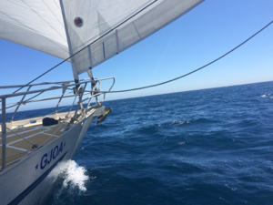
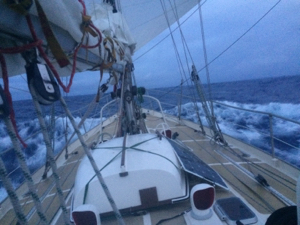
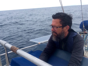